Segovia

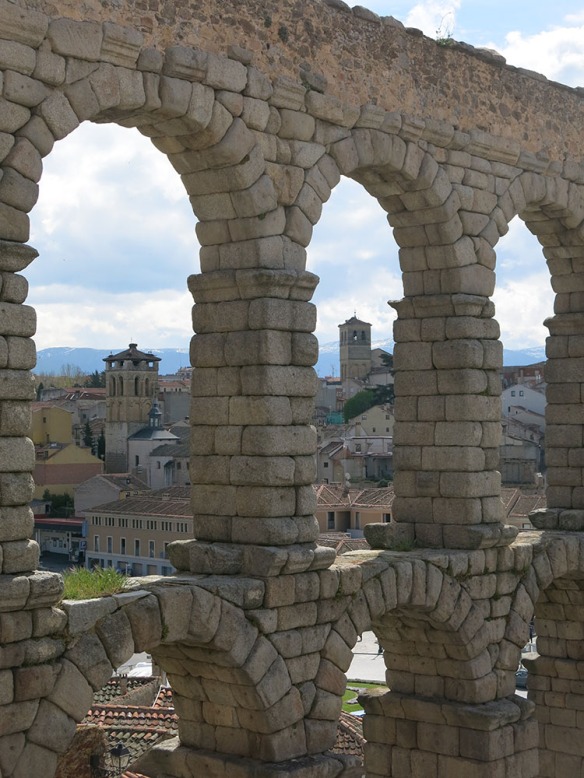
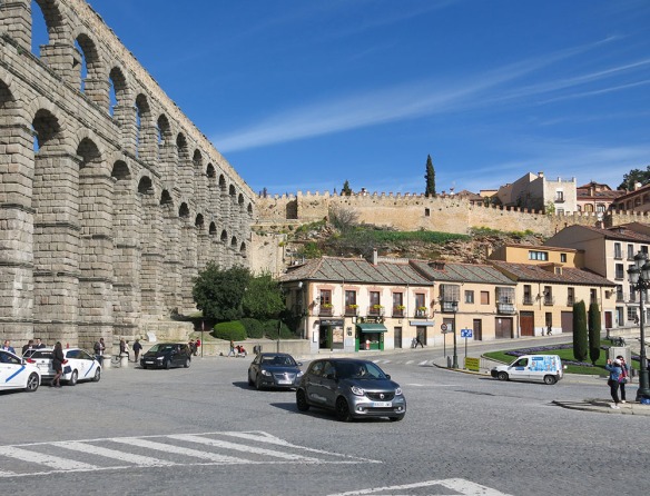
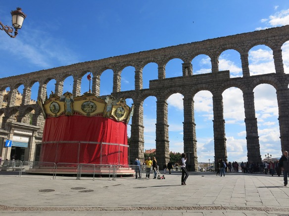
The first recorded mention of a settlement in what is today Segovia was a Celtic possession. Control later passed into the hands of the Romans. They left behind the most dramatic structure, the 12 mile aqueduct, of which a mile or so remains.

Segovia_Aquaduct_Pan_3_Modify_1000

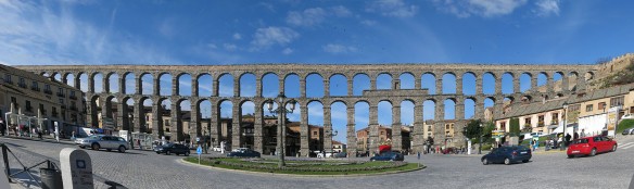
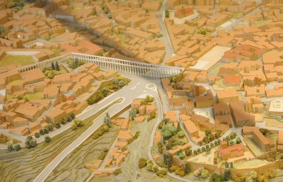
The bus from the Renfe train station drops you right here; so there’s no question about the importance of this historic structure to the city’s reputation. It’s a bit hard to figure out exactly how it worked from what remains. The origin was a river about 11 miles off to the left of the picture and the terminus was the Alcazar or castle, located a mile or so straight ahead as you’re looking through the arches. To accomplish this the aqueduct makes a turn at the right end of the photo above and then continues in a tunnel for the rest of the length. From the layout of the city today, and the topography, it’s hard to read all of that as you walk around. But regardless, it’s pretty impressive. Here’s a photo of a model of the city that we found in the information center.

Segovia_Model_1458_1000

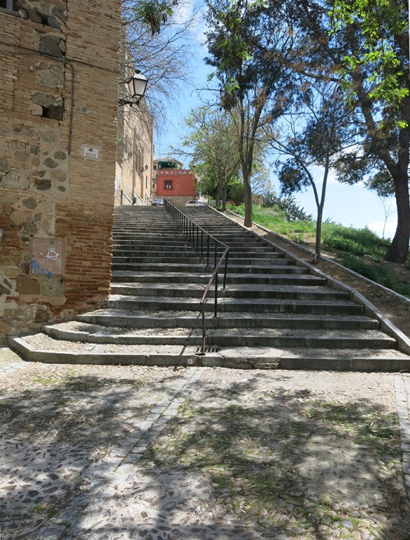
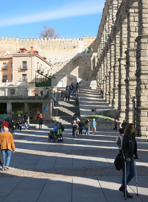
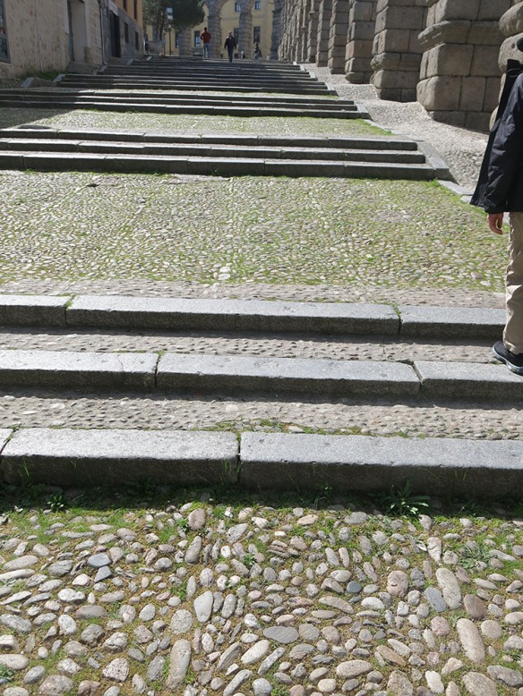
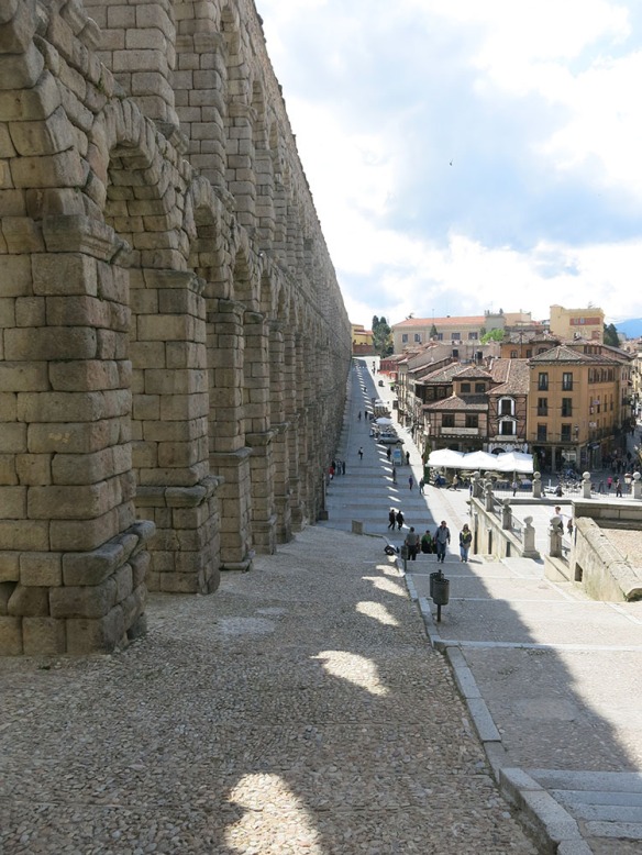
We decided to walk the length of what remains to see how the Segovians live with it. At certain times of day – mid morning here – it casts evocative shadows, highlighting the stairs and slope of the hillside.

Segovia_Aquaduct_1443_1000

Segovia_Aquaduct_Stramp_1462_1000

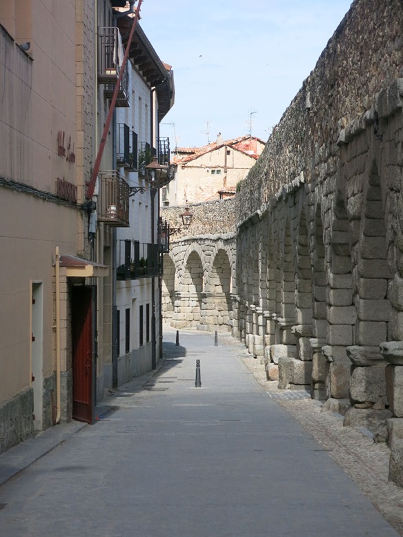
As far as is evident, the city has simply grown up around the aqueduct; but at the same time no other structures have been built into or against it.

Segovia_Aquaduct_street_1471_1000

I would have expected the Romans, skilled engineers and builders as they were, to have created curved corners for simpler water flow; but they chose to just create angles instead. From some vantage points the views through the arches focus elements of the city.

Segovia_Aquaduct_1497 _1000

And speaking of engineering, here’s another surprise – the engineers left a lot of the critical decisions up to the stone masons, such as the composition of the arches.

Segovia_Aquaduct_Arch_Comparison_1480_1000

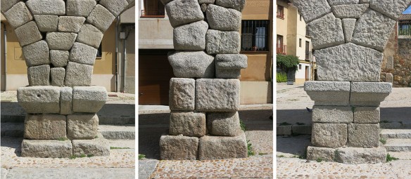
I had initially assumed that the stone patterns, being absolutely critical to the stability of the arches, would be consistent; but then I noticed that some of them varied notably – such as the one in the center. I would also have expected the weight and forces of the arches to be stabilized by a large bottom stone such as at the right; but obviously that was not always the case. But then, it hasn’t fallen for 1800 or so years so it’s hard to complain. We came eventually to the end of what remains.

Segovia_Aquaduct_End_1477_1000

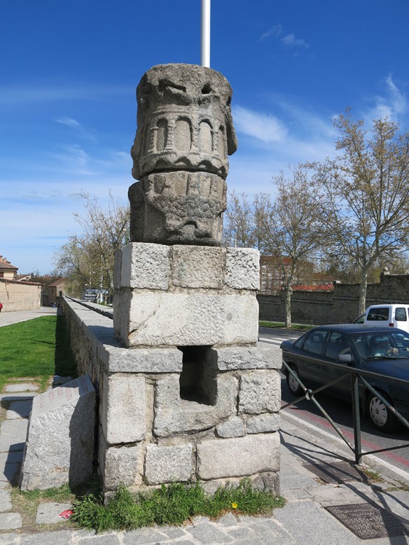
There were structures like this every so often, likely for maintenance, where you could even get a view of the channel inside.

Segovia_Aquaduct_channel_1475_1000

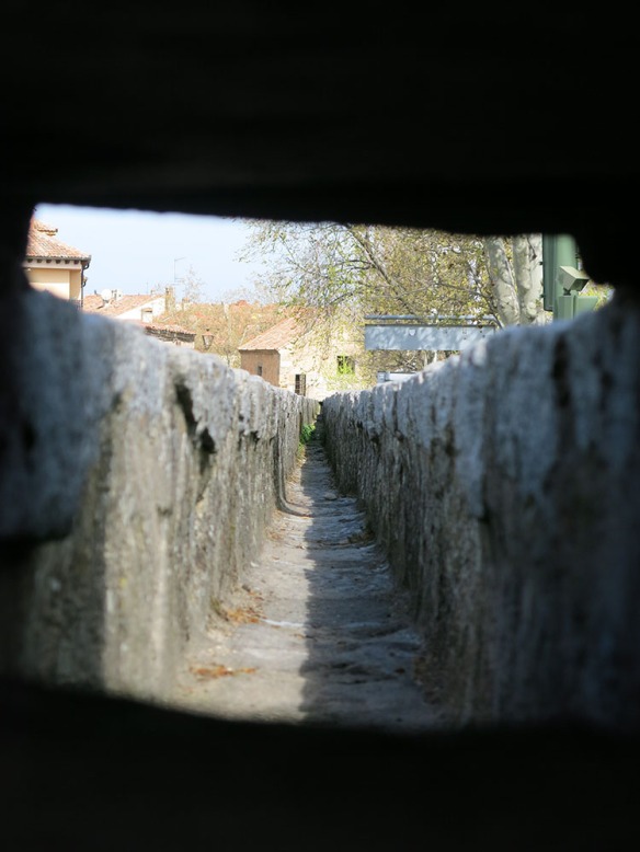
I’m assuming that it was lined and had a top stone to minimize leaks and intrusions from plants, birds and animals. We worked our way back down to the city plaza.

Segovia_Aquaduct_1495_1000

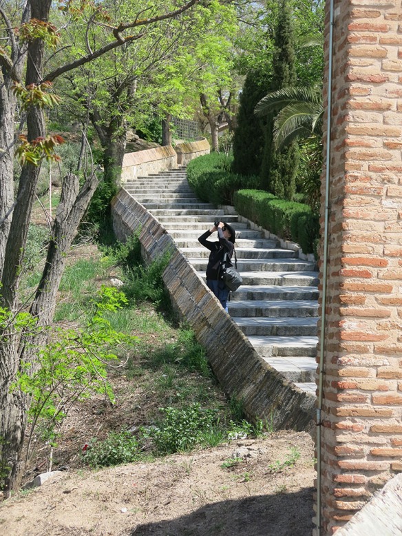
and then up to the other end just to see the whole thing.

Segovia_Aquaduct_1439_1000

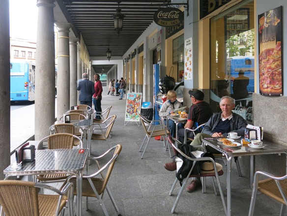
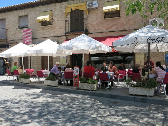
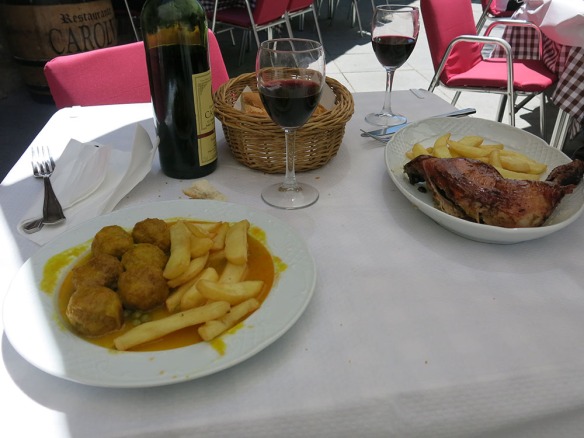
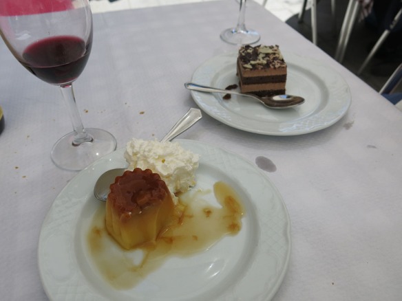
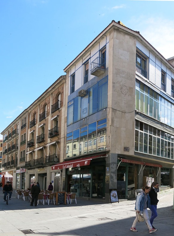
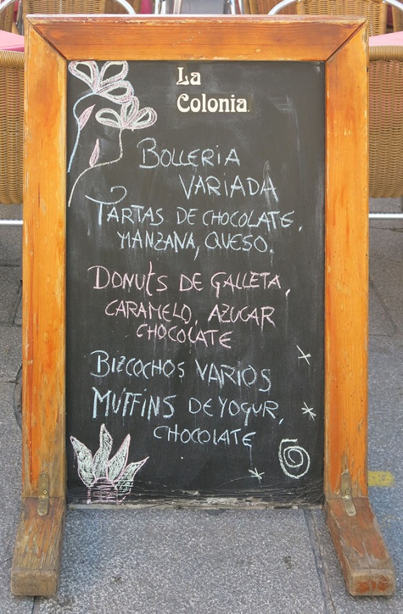
Today it ends pretty much as you see it; but originally it turned and went underground. So we turned and headed down the tourist route to find a cafe con leche, in this case at La Colonial, a pleasant place for both locals and visitors.

Segovia_Coffee_1451_1000

Segovia_Coffee_1447_1000

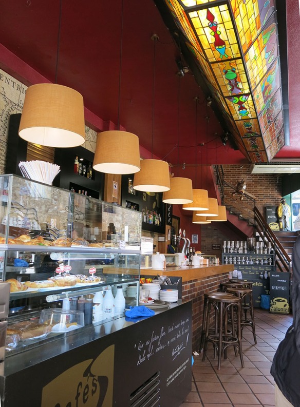
Here’s what helps to draw you in.

Segovia_Coffee_1452_1000

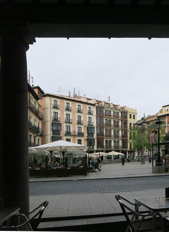
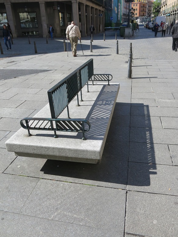
And if you want to sit outside instead you can use one of their tables or one of the benches designed and provided by the city. Nice the way the shadows work.

Segovia_Seating_1450_1000

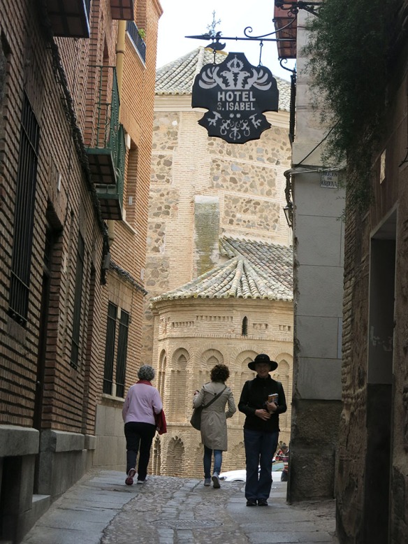
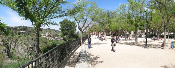
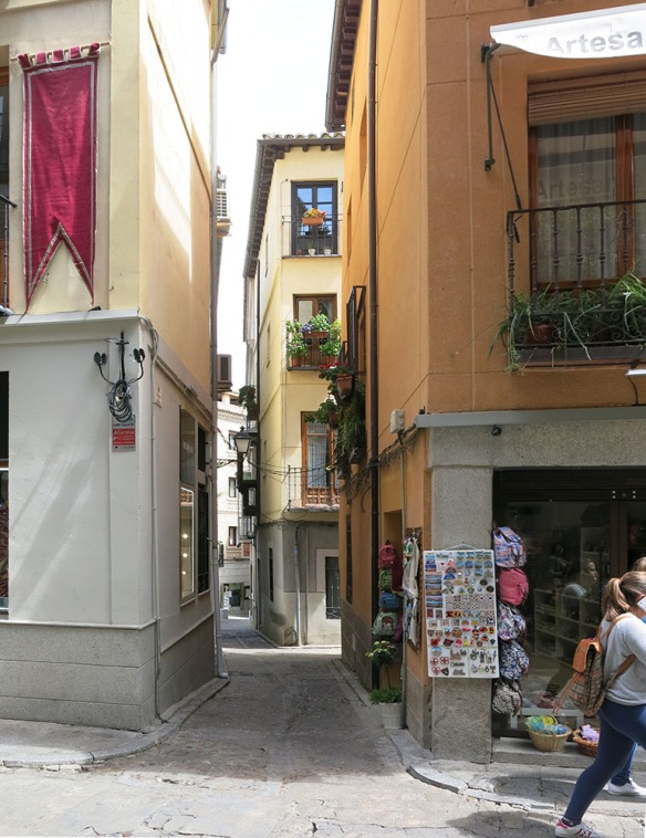
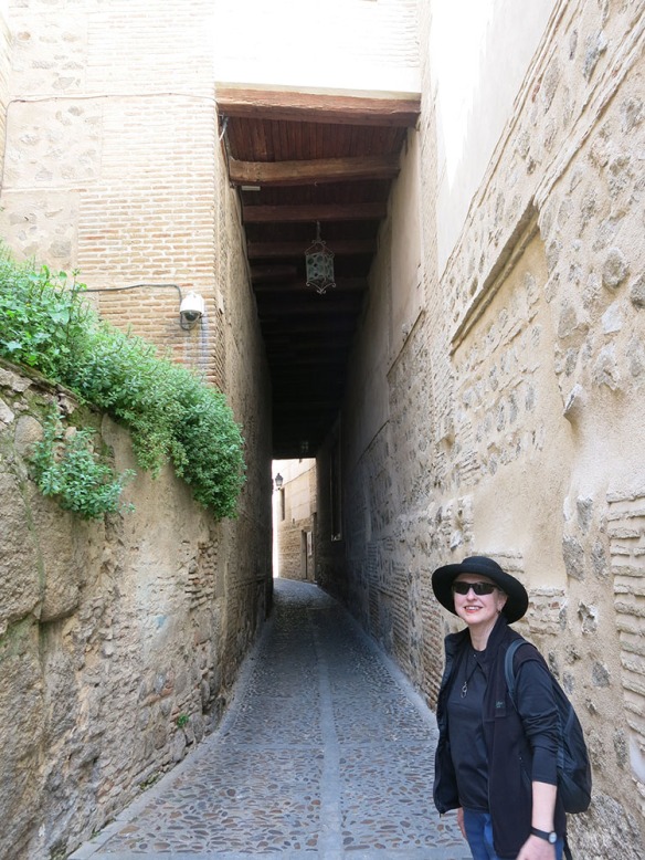
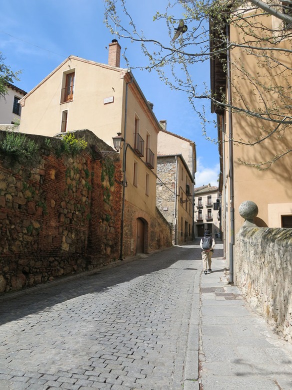
We decided for this hilltop exploration of the rest of the city to work our way around the edges to the Alcazar and then back towards the center to the Cathedral and Plaza Mayor. A lot of this is familiar from other hill towns of course. The streets are narrow and houses are wedged in every which way.

Segovia_Streets_1517_1000

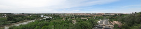
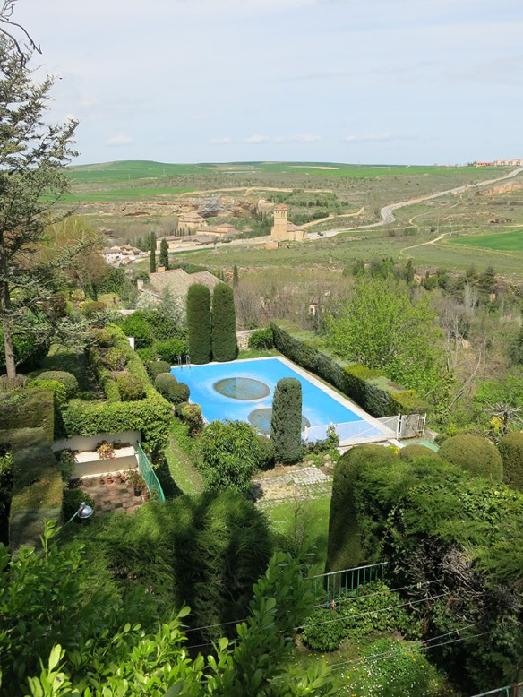
But the views from some of the streets were interesting. Here’s the back of a villa. Must be nice to be able to perch your pool on a steep hillside. Notice that the land in the background is mostly agricultural.

Segovia_HillView_1524_1000

Through planning, good luck and/or a desire to save land for agricultural uses, many of the new towns around Segovia seem to be pretty compact.

Segovia_Hill_NewTownView_1523_1000

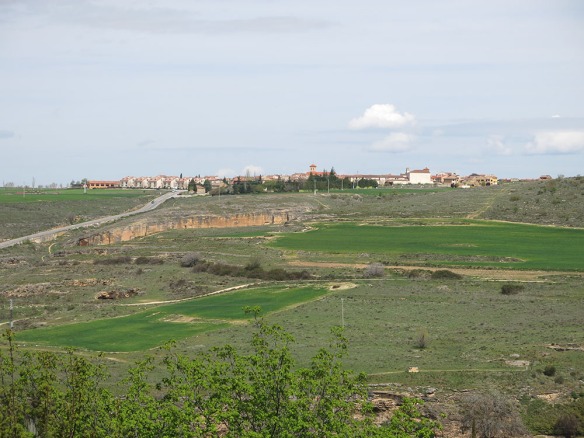
But we also saw areas here and there that had that old familiar car-dominated sprawl.

Segovia_HillView_1511_1000

The desires that have driven Americans for 300 years to keep moving are catching on here and there in places like Spain as well. People like to drive here; and since the narrow streets of the old towns are SO not friendly to driving, there’s a real desire to have wider roads, room to park and to go faster. So while we enjoyed lots of compact cities and towns and the transit that makes them viable, we also experienced the desire to get away from those things and have an (apparently) easier life.

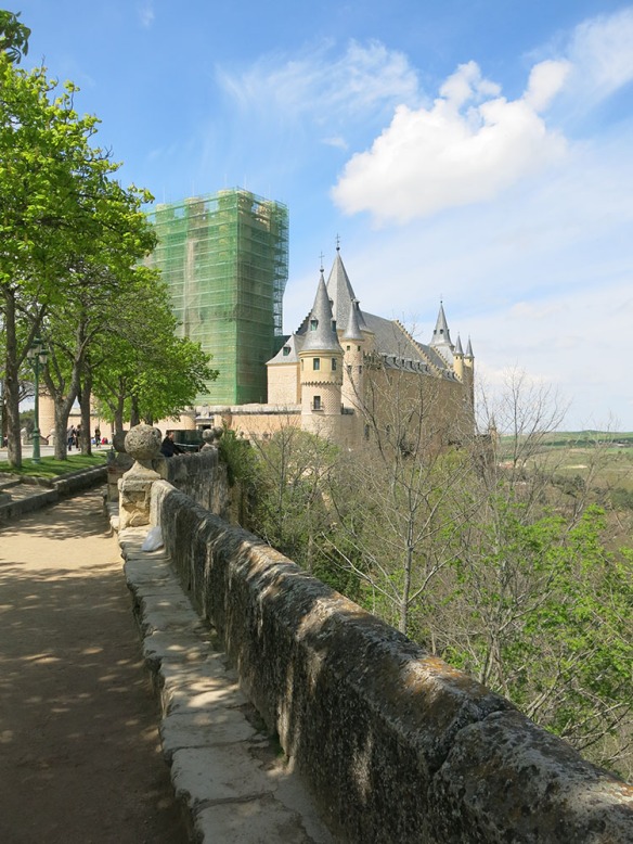
We came to the ‘end’ of the hill and the Alcazar or castle. It was in the middle of some serious repairs so we didn’t go in.

Segovia_Alcazar_1526_1000

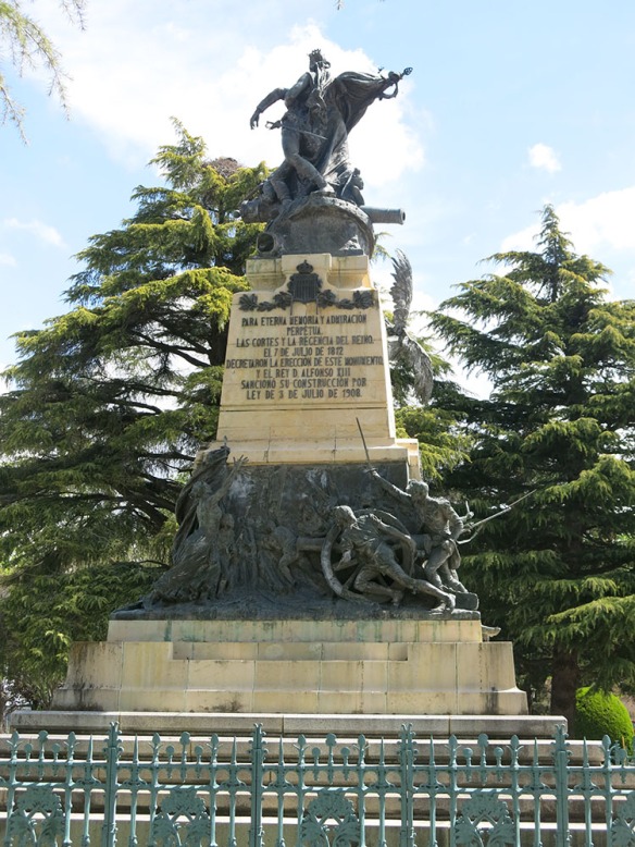
A war memorial to a battle in 1812 was set appropriate in the plaza in front.

Segovia_Alcazar_1812Memorial_1529_1000

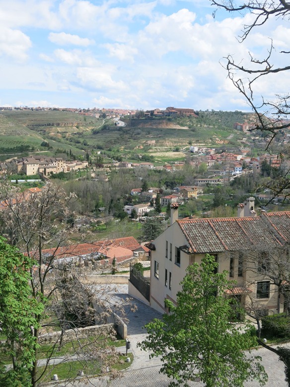
We then skirted the other edge of the hill in the opposite direction towards the cathedral.

Segovia_Cathedral_1531_1000

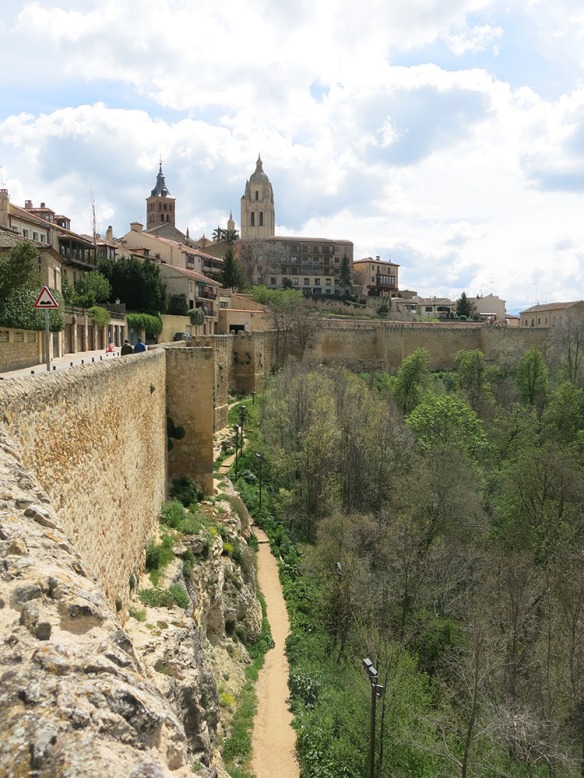
The city walls have been lit from below so as to be visible from a nearby road. Newer housing gets to reach a bit higher to catch the view.

Segovia_Cathedral_1533_1000

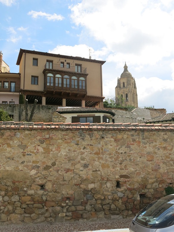
And the cathedral periodically catches your eye as the streets align towards it.

Segovia_Cathedral_1519_1000

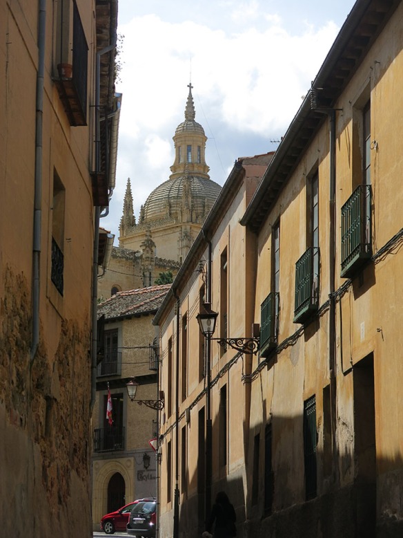
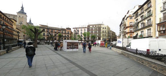
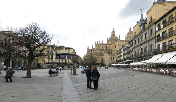
You actually approach the Cathedral from the Plaza Mayor. It’s the center of commerce – and now a focus for tourism – for the city, with lots of restaurants and businesses.

Segovia_Plaza_Mayor_LookN_1000

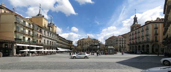
The Cathedral sits at the opposite end, though not symmetrically oriented towards it.

Segovia_Plaza_Mayor_LookS_1000

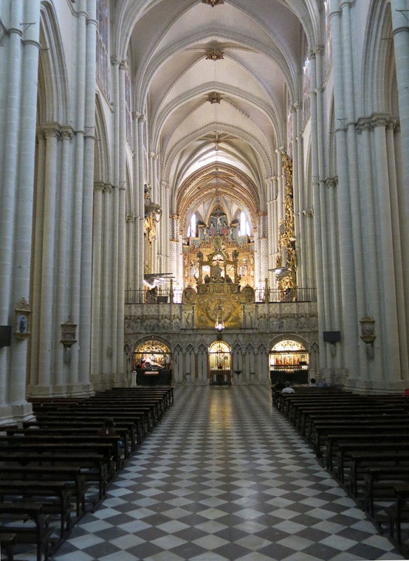
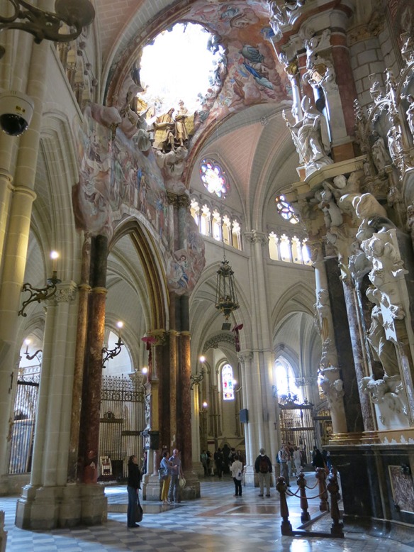
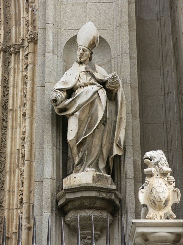
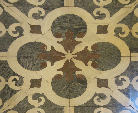
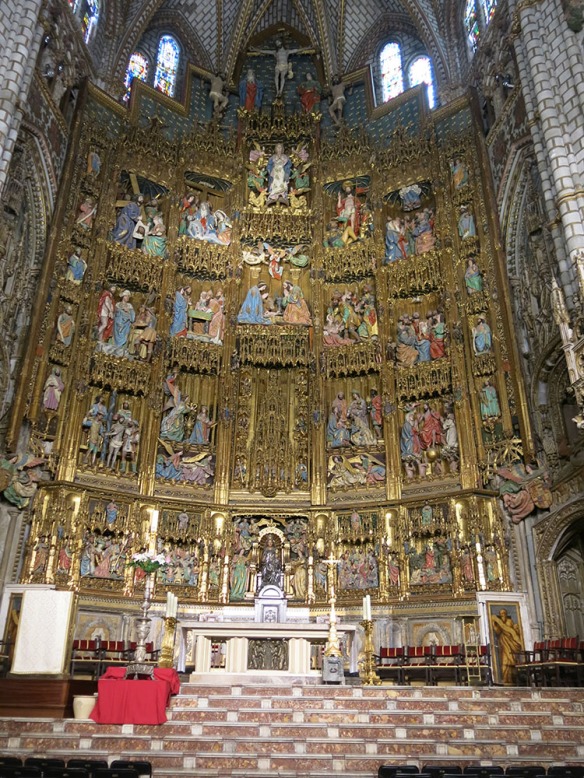
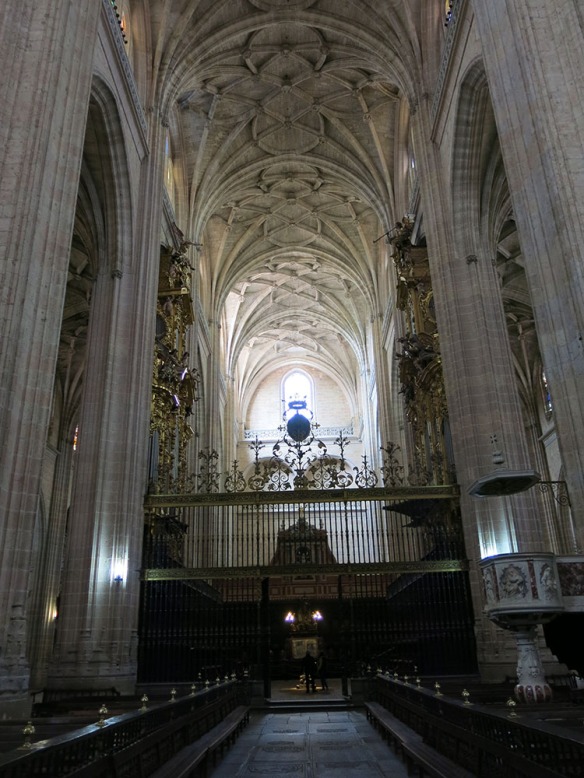
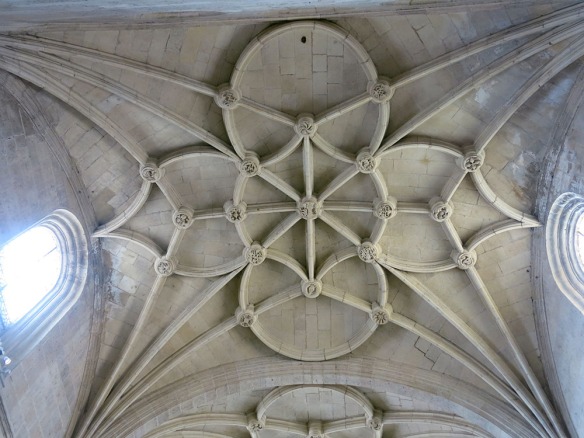
We took a brief tour. Though we’re not cathedral aficiondos, we like to see what the general tone of the design is, since there’s quite a variety in detail. This one is about in the middle of the range.

Segovia_Cathedral_1544_1000

Segovia_Cathedral_1557_1000

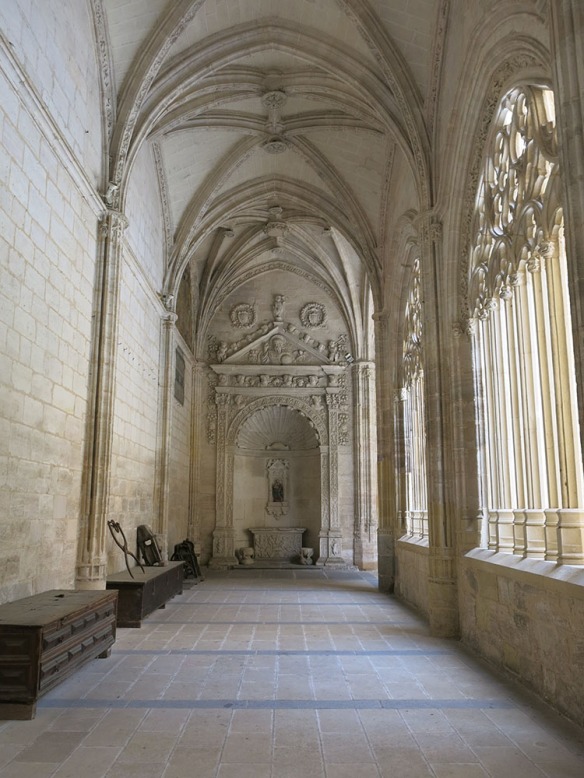
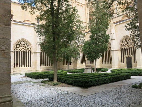
I personally am more attracted to the cloisters. They seem to embody the sort of contemplation that is appropriate in this setting.

Segovia_Cathedral_Cloister_1551_1000

Segovia_Cathedral_Cloister_1549_1000

After this visit we made our way back to the aqueduct to catch our bus. It was not without some irony that I noted how the circus of all this tourism washing through town is being celebrated by the 2000 year old Roman structure.

Segovia_Aquaduct_1453_Merry_1000

Back to Madrid !


Toledo

On this day, we left from the Madrid Atocha station

Atocha_0972_1000

for a 30 minute ride south to Toledo, located in central Spain, 70 km south of Madrid. It is the capital of the province of Toledo and the autonomous community of Castile-La Manch. It was declared a World Heritage Site by UNESCO in 1986 for its extensive cultural and monumental heritage and historical co-existence of Christian, Muslim and Jewish cultures. It provides a strong first impression when seen from river level.

Toledo_FromEntryBridge_1000

That’s the Alcazar or castle/royal residence at the top, which when I thought about it was unusual. The usual pattern is to find the cathedral at the top along with the main plaza. That was not the case here. The river is the Tajo; and in this view it’s flowing away from you and clockwise around the city about 3/4 of the way. The fourth side is the land to the right in the photo that connects the historic city with today’s modern one. This land side was fortified with a wall and gates, today replaced in part by a parking garage and series of ramps and escalators – or you can just ride the shuttle bus from below.

Toledo_1009_ViewFromBelow_1000

I thought it might be easier to visualize if I just took you quickly around the edge of the hill along the river.

Toledo_FromAlcantaraBridge_3_1000

This view looks back to the bridge from which I took the first picture. The city is to the left. And the view below looks the other way from about the same point, showing the river flowing away to the south.

Toledo_FromAlcantaraBridge_2_1000

From above, the gorge is more dramatic and also reveals some likely 19th century mill race constructions to divert the flow, as well as current highway access.

Toledo_AlcantaraBridge_1_1000

A similar pattern occurs on the west side, looking north towards another old bridge.

Toledo_SanMartinBridge_2_1000

and then from that bridge looking upstream, city on the left.

Toledo_RiverFromAbove_2_1000

and finally, a broad view to the north and the modern town with the river flowing to the north and then to the west all the way across Spain and Portugal where it enters the Atlantic ocean at Lisbon.

Toledo_RiverFromAbove_3_1000

Protected by all this water, walls and hill, the city of Toledo is a compact maze of small streets connecting its major features, starting with the town plaza (no church).

Toledo_1028_Plaza_1000

We’re here relatively early (10:00) so delivery trucks are still unloading and shop owners setting up for the daily surge. The train runs non-stop from Madrid every hour so there is a parallel hourly tide of tourists washing up the hill. If the trees appear a bit abbreviated, they are. They like pollardizing their trees here, cutting them way back each year and letting them put out small branches and leaves like big lollipops. We started our day with our usual caffe con leche, essentially a latte without the cute design in the foam.

Toledo_1034_Caffe_1000

From this perch the view of the plaza is pretty benign

Toledo_1032_Plaza_1000

And the plaza itself is one we’ve seen many of, with a pedestrian scale, lots of places to eat and apartments and rental spaces overlooking it. It’s all a bit crazy with traffic though, in that the tourist shuttle buses all queue here and make a lot of noise. It’s more fun when you move on to the smaller streets, of which Toledo has a lot. We chose to work our way along the tourist trail to the cathedral, on a lower slope on the south side of the city.

Toledo_1089_Sign_1000

The exterior is hard to photograph because it doesn’t front on a main plaza as do many of the cathedrals we’ve visited. So from the outside you get snapshots like the one above. The inside presents one of the most spectacular collection of spaces in Spain.

Toledo_1065_Cathedral_1000

Over the top and meant to awe. And a touch I hadn’t seen in a church of this period before – painting overlaying the stonework in an almost Rococo manner.

Toledo_1077_Cathedral_1000

Nice carving in places to show they hadn’t lost their touch.

Toledo_1060_Cathedral_1000

And lovely floor patterns, always a favorite of mine.

Toledo_1086_CathedralFloor_1000

But the piece de resistance was the altar screen, about which I said to Jane at the time that it had so much gold it was almost pagan in its worship of material wealth.

Toledo_1074_Altar_1000

After all that it was a distinct relief to visit a small studio where contemporary craftspeople were making medallions by working gold thread into the surface of treated steel shapes. The wood block has a magnetic top to hold the steel in place.

Toledo_1093_Inlay_1000

Even watching it up close I couldn’t make out how it actually happened.

Toledo_1097_Inlay_1000

From the cathedral area we worked our way around to the mostly non-tourist west side of the city where the old Jewish quarter and the El Greco museum are located. There’s also a school, park, and playground there, providing a quieter and more ‘normal’ visitor experience.

Toledo_JardinesTransito_1000

Just off the corner of the park we found a place for lunch.

Toledo_1135_Lunch_1000

And here’s the sort of thing that’s commonly found for lunch: a glass of vino tinto, some form of meat, in this case some meat balls and chicken, very mediocre potatoes, and good bread but usually more than you need.

Toledo_1132_Lunch_1000

On the other hand, they had the best flan for dessert that I’ve had in a long time so I decided that it deserved a photo as well.

Toledo_1133_Lunch_1000

After this pleasant break we worked our way down to one of the (now) pedestrian bridges which at one point were the guarded entrances to the city.

Toledo_1140_Ramp_1000

In these parts of the city, where it’s not possible to drive and walking means going up and down stairs, we had the place to ourselves and could enjoy private settings like this garden

Toledo_1139_Garden_1000

Or, if you were inclined, as some of us are, you could check out the local birds.

Toledo_1118_Birding_1000

The paths eventually led to the bridge, which is seen in the distance on the right, below,

Toledo_SanMartinBridge_1_1000

and from the closer paths here, reaching out to the town outside the walls.

Toledo_1142_Bridge_1000

Both ends of the bridge were guarded by towers,

Toledo_1148_BridgeGate_1000

which in their day, and the limits of warfare at the time, were effective.

Toledo_1161_BridgeGate_1000

Once back up the hill, we encountered more walls and gates. These were required because there was no river on the north side of the city;

Toledo_1168_Gate_1000

but they led to an interesting set of discoveries, which were a series of small schools, institutes and colleges, hidden away in the less-touristy parts of the hill. Some, like this one, were more contemporary in design.

Toledo_1170_1000

Others were more traditional and in keeping with other structures nearby.

Toledo_1180_1000

Unfortunately, along with all this wisdom we encountered more and more cars driving through the same narrow streets we were walking, like this one,

Toledo_1191_Narrow_1000

or this one where we almost got squeezed out

Toledo_1195_Narrow_1000

so we took ourselves back to the train station

Toledo_TrainStation_1000

and our waiting chariot

Toledo_1225_Renfe_1000

for the half hour trip back to Atocha Station and Madrid

AtochaStation_ViewAtrium1_1000

As a side note, this is the original train hall for the Atocha station, the station itself being the brick building in the background. At some point the station got to be too small, a more ‘modern’, and pretty oppressive, set of platforms was built; and this old hall was turned into a generous and comfortable waiting space. Transportation trade-off.


Touring the Town

Since there’s so much history packed into this relatively small city, we decided to take one of the free tours offered to tourists. A group of “urban docents” leaves from the entrance to the Roman Baths and takes a couple of hours to cover the highlights.

Bath_Tour_3265_600_Guides

Part informant, part entertainer, part proud citizen, and often (mildly) salacious story teller, each guide becomes a part of Bath in the process of explaining it to us newbies. The city, its abbey and its baths have been attractions for centuries and thus the city has also had a collection of politicians, rogues, hustlers, and celebrities. The guides loved to stop every so often and let us in on the behind-the-scenes realities of different Roman or Georgian customs. It was a fun couple of hours.

As it turns out, there are still baths available in bath, and they’re adjacent to the historic Roman ones – the modern, glassy building below.

Bath_Spa_3268_600

We didn’t sample them, but were assured that the spa facilities were very classy. In this part of the city we wandered through a mixture of commercial and retail streets, many of which may have been residential originally but now serve to meet the needs and wants of the waves of tourists that arrive during the day. This Kings and Queens bath sat just a couple of blocks from the main Roman baths but was not open for viewing.

Bath_Streets_3264_600_KQBath

The street scenes below give an idea of the kind of variety we saw in the commercial area – including lots of sidewalk cafes and related activities.

Bath_Streets_3227_600_Cafe Bath_Streets_3229_600_Cafe Bath_Streets_3230_600_Arcade   Bath_Streets_3272_600

This building is not a great piece of architecture but I took the picture because it was one of the few I saw that was not ‘traditional’ – though it did use the local stone.

Bath_Streets_3239_600

Through a collection of these streets we gradually worked our way up to the first two of the big architectural sites in Bath, the Circus (Circle) and the Royal Crescent. When viewed from the air – or our 3D map, the Circus, along with Queens Square and the adjoining Gay Street, form a key shape, which is a masonic symbol similar to those that adorn many of Wood’s buildings.

Bath_Map_RoyalCR_5988_600

The Circus, originally called King’s Circus, was part of Architect John Wood the Elder’s grand vision to recreate a classical Palladian architectural landscape for the city. Other projects included nearby Queen Square and the Forum (which was never built). The Circus is the culmination of Wood’s career, and is considered his masterpiece. (background material from Wikipedia).

Bath_Circus_3220_600_Curve

Wood’s inspiration was the Roman Colosseum, but whereas the Colosseum was designed to be seen from the outside, the Circus faces inwardly. Three classical Orders (Greek Doric, Roman/Composite and Corinthian) are used, one above the other, in the elegant curved facades. Note the wrought iron fencing above. When these houses were built, the kitchens and servants areas were typically on the lower level and reached via a daylight courtyard between the house and sidewalk. Entrance to the main level of the house was effectively by bridge across a moat.

The frieze of the Doric entablature is decorated with alternating triglyphs and 525 pictorial emblems, including serpents, nautical symbols, devices representing the arts and sciences, and masonic symbols.

Bath_Circus_3216_Figures_600 Bath_Circus_3217_Figures_600

The central area was paved with stone setts, covering a reservoir in the centre that supplied water to the houses. In 1800 the Circus residents enclosed the central part of the open space as a garden. Now, the central area is grassed over and is home to a group of old plane trees. Between 1758 and 1774 number 17 The Circus was home to Thomas Gainsborough and used as his portrait studio. The formality of the front facades actually conceals some clever developer devices. The first is that the facades were all developed in a repetitive and consistent manner; but the facades did not control the use of the buildings behind. Though the typical house was three bays wide; you could in fact arrange to purchase whatever width you needed and could afford.

Bath_Circus_3293_600_Front

The other is that the rules went out the window around back. Here, you could pretty much have whatever clever extensions and details you wanted.

Bath_Circus_3295_600_Rear

Just a few blocks away, the Royal Crescent is a row of 30 terraced houses laid out in a sweeping crescent. Designed by the architect John Wood the Younger and built between 1767 and 1774, it is among the greatest examples of Georgian architecture to be found in the United Kingdom and is a Grade I listed building. Although some changes have been made to the various interiors over the years, the Georgian stone façade remains much as it was when it was first built.

Bath_RoyalCR_Pan_600

The right hand end of the crescent was originally the end town home of the crescent but has been converted into a Georgian Museum in an effort to convey the lifestyle of that time. We toured the museum (no photos allowed) where people in Georgian dress explained the mores and morals of the 18th century.

Bath_RoyalCR_3286_600

A small outbuilding to the rear of the museum houses offices and information services.

Bath_GeorgianMus_3459_600

It had been remodeled in an attractive and contemporary manner and also solved some tricky access and storage issues for the main museum building.

Bath_GeorgianMus_3455_600_new

The view below clearly shows the contrast between the formal fronts and individual rears of the homes, similar to those in the Circus – which you can just make out in the top left portion of the picture.

Bath_Royal_crescent_aerial_Wikipedia_600

Many notable people have either lived or stayed in the Royal Crescent since it was first built over 230 years ago, and some are commemorated on special plaques attached to the relevant buildings. The Royal Crescent now includes a hotel and a Georgian house museum, while some of the houses have been converted into flats and offices. It is a popular location for the makers of films and television programs.

From this dramatic experience the tour worked its way back downhill to the Bath Assembly Rooms. During the Georgian era Bath became fashionable. The architects John Wood, the Elder and his son John Wood, the Younger laid out new areas of housing for residents and visitors. Assembly rooms had been built early in the 18th century, but a new venue for balls, concerts and gambling was envisaged in the area between Queen Square, The Circus and the Royal Crescent. Robert Adam submitted a proposal that was rejected as too expensive. John Wood, the Younger raised funding through a Tontine and construction started in 1769. The New or Upper Assembly Rooms opened with a grand ball in 1771 and became the hub of fashionable society, being frequented by Jane Austen and Charles Dickens, along with the nobility of the time.

Bath_Assembly_3296_600

The Bath stone building has rooms arranged in a U shape. There are four main function rooms in the complex: the 100-foot-long (30 m) ballroom — the largest Georgian interior in Bath; the tea room; the card room; and the octagon.

Bath_Assembly_3297

In the 20th century they were used as a cinema and in 1931 were taken over by the Society for the Protection of Ancient Buildings and restored. They were bombed and burnt out during the Second World War, with restoration undertaken by Sir Albert Richardson before reopening in 1963. They are now owned by the National Trust and operated by Bath and North East Somerset Council for public functions. The basement of the building provides a home to the Fashion Museum.

Bath_Assembly_3301_600

The rooms have Whitefriars crystal chandeliers and are decorated with fine art.

Bath_Assembly_3299_600_Chandelier

At the end our our tour we worked our way back to the Roman Baths, on the right below, and across from them the Bath Abbey.

Bath_Abbey_3259_600

In the view below, taken with the baths behind me, the benches are set up in a rectangle around the ‘busker area’ where musicians, jugglers, and story-tellers entertain tourists taking a break

Bath_Abbey_3252_600_BuskerArea

Bath Abbey was a Norman church built on earlier foundations, although the present building dates from the early 16th century and shows a late Perpendicular style with flying buttresses and crocketed pinnacles decorating a crenellated and pierced parapet. The choir and transepts have a fan vault by Robert and William Vertue.  The nave was given a matching vault in the 19th century.

Bath_Abbey_Nave_Fan_Vaulting_Wikipedia_600

Some of the exterior details were attractive – especially here where the stone carving is laid over the lacy glass background.

Bath_Abbey_3256_600

All in all a very helpful tour.